
TRIP POLICY: Please limit your sign-ups to 1 weekend trip and 2 weekday trips per month. Also, please take a moment to read our other policies here.
Slow Birding at the Evergreen Community Center Park (Southeast San Jose)

Join us for a relaxing morning of slow birding at the Evergreen Community Center Park, a beautiful suburban park with a riparian corridor. This trip’s priorities will be a slow pace and short distance. This is a 0.5 mile round trip on a fully paved, partially shaded, out-and-back trail to a short wooden bridge that overlooks the Yerba Buena Creek (trail photos below). Site highlights include ample free parking, restrooms, water fountains, built-in seating, and mild/gradual elevation changes. This field trip was designed by an independently ambulatory SCVBA volunteer who requires trails of little to no elevation changes and typically takes a sitting break on a collapsible stool every 0.1-0.2 mile. We are looking forward to seeing some neighborhood favorites including the Spotted Towhee, Oak Titmouse, Red-shouldered Hawk, Nuttall’s Woodpecker, Chestnut-backed Chickadee, and more! Hope to see you there!
Trip Difficulty: 0.5 mile, paved trails, little or no elevation gain, some shade. See additional details below.
Leaders: Susan Tenney (408) 802-6184 , S M, and Ryan Ludman (248) 719-1331
Beginner Friendly, Family Friendly All Ages, 1 mile or shorter, 2 hours or less
Meet: Evergreen Park at Park Estates Way (Latitude/Longitude: 37.297068, -121.768508): When looking at the park from ~2818 Park Estates Way, look at the paved path on the right - the first picnic table there is the meeting spot.
Directions: From US-101 in San Jose, exit Yerba Buena Road. Travel east for about 2.5 miles, then turn right onto San Felipe Road. Make the first left onto Park Estates Way, the park will be on your left. Latitude/Longitude: 37.297068, -121.768508
Languages: English will be the primary language of this field trip, but other languages spoken by our trip leaders include Tamil and Spanish.
Facilities: ADA accessible bathroom, drinking water, cell phone service
Parking Type and Fees: paved parking lot, street parking.
Additional Accessibility Details
Distance and Surface Type: The total distance covered will be a 0.5 mile round trip from the adjacent free street parking. Other than the ~100-foot wooden bridge (which marks the midway, turnaround point of our trip), the trail is fully paved with no trail barriers that need to be stepped over. Both the trail and the bridge are 5 feet wide. For those who are not able to go onto the bridge, there is a partial view of the creek area from right before the bridge entrance.
Parking:
1) Free street parking - option 1
Address: ~2818 Park Estates Way, San Jose
Distance from meeting spot: ~100 feet
No ramp from road to sidewalk
2) Free street parking - option 2
Address: ~2848 Park Estates Way, San Jose
Distance from meeting spot: ~0.1 mile
There is a ramp from road to sidewalk (location pin link)
3) Free community center parking lot (50+ spots)
Address: 4860 San Felipe Road, San Jose
Distance from meeting spot: ~0.1 mile (through grass), ~0.2 mile (on the paved path)
4 ADA spots (location pin link) with associated ramp from road to sidewalk
Elevation Changes: The AllTrails app was used real-time during exploration of this route as it documents elevation changes as little as 1 foot. A total of 5 feet of elevation change was noted by the app across the entire 0.5 mile round trip. This change typically occurred in low-grade, gradual slopes (ex: 1 foot elevation change over ~50-100 feet).
Bathrooms (location pin link): Along the route we will be taking, ~0.1 mile from the meeting spot, there is a 2-gender bathroom with metal toilets and 2 stalls (one of which is marked as accessible).
Shade Cover: The tree cover provides frequent patches of shade along the trail.
Water: There are 2 water fountains along the trail. One is at the bathroom entrance (0.1 mile from meeting spot). The second is a little further along the trail (the birds frequently perch on this one).
Built-In Seating along the Route: Within the first 0.1 mile from the meeting spot, there are 4 built-in seating options, located every ~100-150 feet. The first three are backless picnic tables. The fourth is a pair of metal benches with backrests at the children’s playground. There is an additional picnic table collection located ~0.2 mile from the meeting spot – due to the associated higher grade elevation change (rapid 3 foot elevation gain on a packed dirt surface to reach these tables), this collection will not be a planned bird sit location. However, it is available for anyone who may require a sitting break at this point.

Photo 1 (above): Path from closest street parking (option #1) to picnic table meeting spot
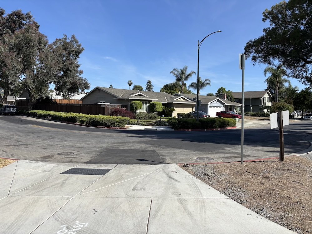
Photo 2 (above): Ramp from road to sidewalk, next to street parking option #2

Photo 3 (above): Path from meeting spot to next picnic table with community center parking lot visible in the background
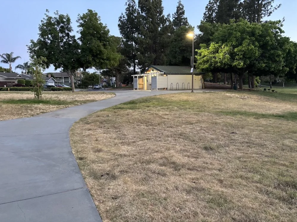
Photo 4 (above): Restroom facilities with water fountain

Photo 5 (above): Metal benches with backs at the children’s playground

Photo 6 (above): Path along the riparian corridor with entrance to wooden bridge visible in the distance

Photo 7 (above): Wooden bridge over Yerba Buena Creek
Banner Photo: Spotted Towhee by John Scharpen
Questions? Email general questions to fieldtrips@scvbirdalliance.org or contact the trip leader for questions regarding the event.
Trip sold out? Please check back later, we often have last minute openings.