South County Regional Wastewater Authority, Gilroy (Winter):
An Oasis For Wintering Ducks, Shorebirds and Raptors
by Rick Herder
Explore this oasis in Gilroy! The levees along settling ponds with varying amounts of water and vegetation attract ducks, shorebirds, raptors and more. This site is never crowded and has no hills, just level dirt roads, easy for walking and driving.
Trip Covers: November - April
Key Birds: Canvasback, Short-billed Gull, White-faced Ibis, Peregrine Falcon
How to Bird
The South County Regional Wastewater Authority site is a wastewater treatment plant for Gilroy and Morgan Hill. Most human activity is in a relatively small area where the water is treated. The rest of the site consists of large settling ponds. The site is in the middle of the south valley, intentionally placed away from residential areas. It is also far from any other sizable wetlands or lakes, but it is in the path of migrants making their way to or from the bay. If you’re lucky, it can be full of birds. It is also easy to bird, you can bird from your car. In fact, birds are less likely to scatter if you stay in your car.
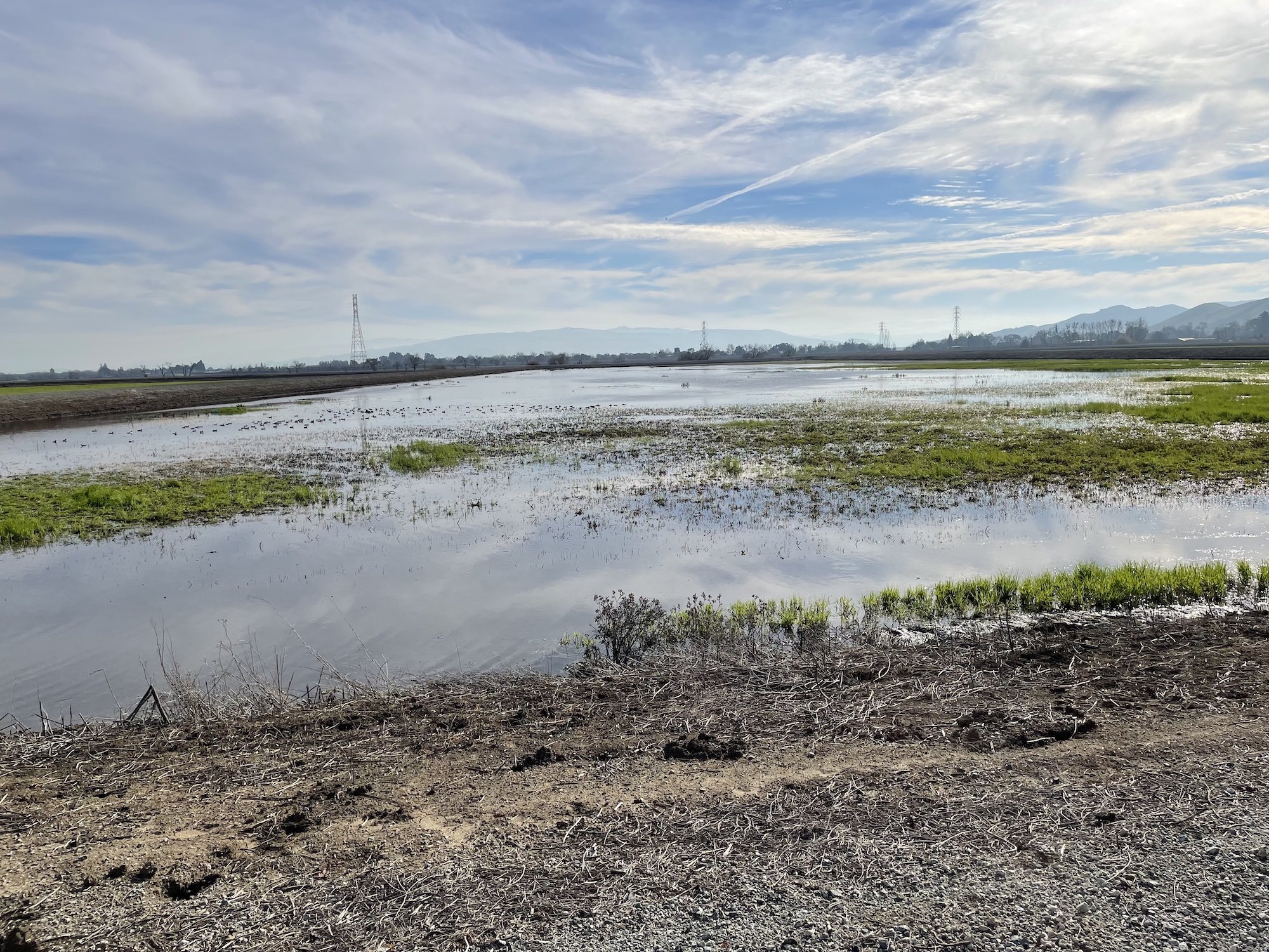
One of the Obata Ponds by Rick Herder.
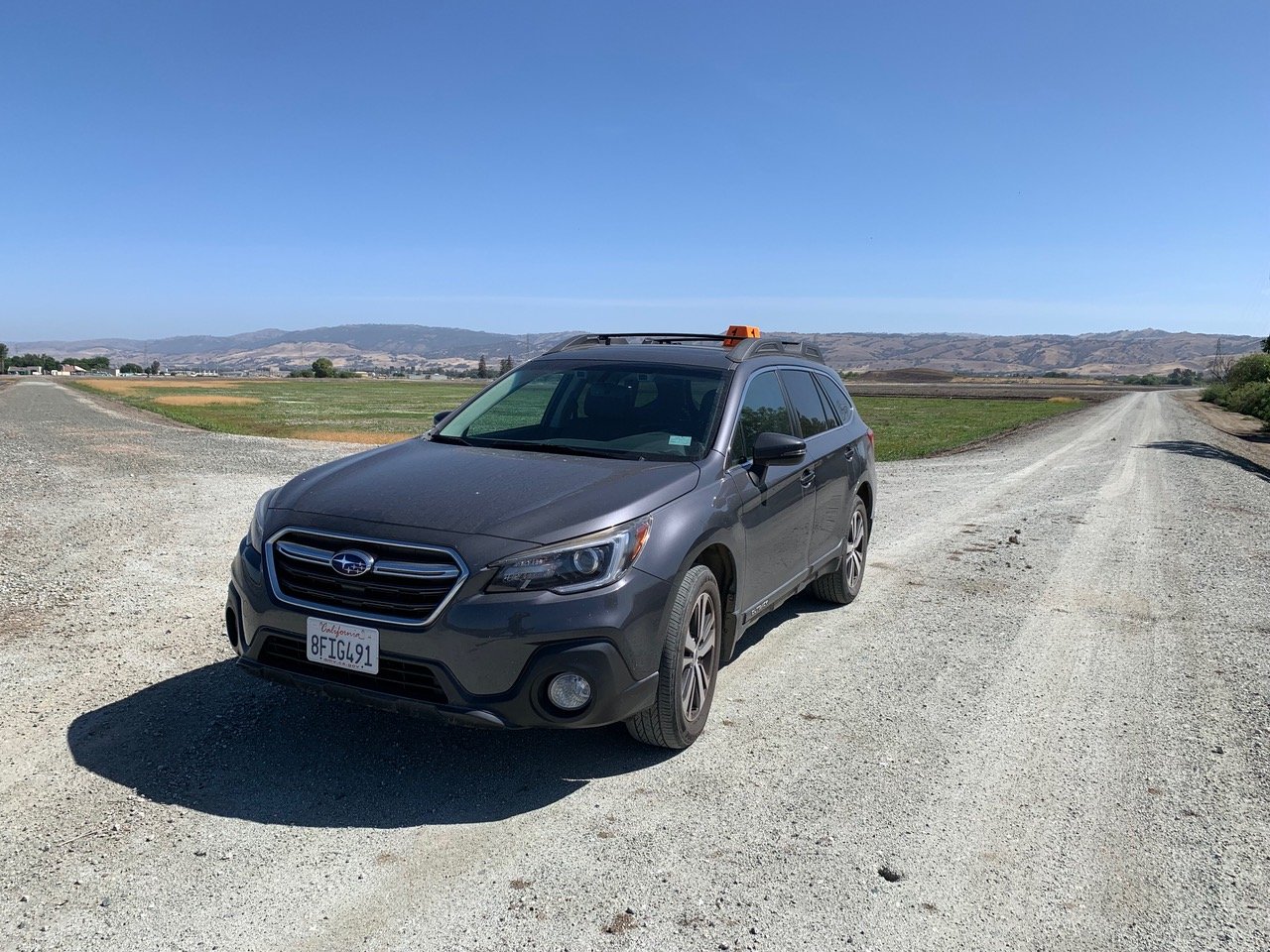
You must check in at the Administration Office (#1 on interactive map) before birding the site. (During COVID restrictions don’t forget your mask.) When you check in, you’ll receive a Birding FAQ containing a map and an orange magnetic plastic “hat” for your car top, showing that you’re a registered visitor. Once you’re registered, there are just a few restrictions about where you can drive or walk, but obviously you want to avoid getting in the way of work crews. For example, the Influent Pump Station and Shop west of the entrance gate (#2 on map) is an area to avoid and isn’t an interesting area for birds anyway.
Car with orange magnetic plastic “hat” .
White-faced Ibis by Chris Overington.
After checking in at the administration building, your first stop are the BSE ponds, the 2 big ponds you passed on your way into the facility (#3 on map). These tend to be best for winter ducks. After that, check out the western Obata Ponds (#4 on map) which are better for shorebirds and moisture-loving passerines. Lastly, check out Llagas Creek (#5 on map) and the east ponds. Unfortunately, as of mid-January 2022, the area along Llagas Creek on the east side of the plant is off-limits due to construction. This area is expected to be closed to visitors until 2024.
Administration Building where you must check-in before birding. Photo by Rick Herder.
The water level in the ponds changes dramatically throughout the year. You’ll want to drive by as many ponds as possible checking for birds swimming in the filled ponds or foraging in the ponds with shallow waters and vegetation. A dry uninteresting pond may be next to a pond full of shorebirds, or ducks, depending on the season and water level. A scope is very helpful for all these large ponds.
Blue-winged Teal by Dave Zittin.
The fuller ponds seem to be a favorite spot for Canvasbacks and Ruddy Ducks, and all 3 teal species sometimes occur here together. Watch for White-faced Ibis which are erratic but can occur in any of the ponds. In addition to shorebirds such as Black-necked Stilts and Least Sandpipers, remember to look carefully for Wilson’s Snipe “hiding” in plain sight in the mud.
Wilson’s Snipe by Dave Zittin
The open habitat and water attract raptors. Bald Eagles and Peregrines have been found regularly, as well as more common birds such as Cooper’s Hawk, American Kestrel and Northern Harrier. In the open fields, watch for Loggerhead Shrike and flycatchers such as Say’s Phoebe. Other passerines, such as Western Meadowlarks, American Pipits, Red-winged Blackbirds and Savannah Sparrows, are attracted to these ponds as well.
Peregrine Falcon by Michael Mammoser.
The little Short-billed Gull, which can be hard to find in our area, is common in winter.
Short-billed Gull by Carter Gasiorowski.
This is a site that varies with the seasons, so it is worth repeat visits.
Ready for More? Christmas Hill Park and the Debell-Uvas Creek Reserve are just a few miles away.
Interactive Map
Address: 1500 Southside Drive, Gilroy
Directions: Exit US-101 South at exit 355, Monterey Rd., in southern Gilroy. Turn right onto Monterey Road then right again onto East Luchessa Avenue. Luchessa passes under the freeway then angles right and becomes Rossi Lane and dead-ends at Southside Drive. Turn left onto Southside and follow it to the right through the treatment plant gates. Park in front of the administration building, which is near the center of the complex. Latitude/Longitude: 36.982550, -121.533083
Treatment Plant gates by Rick Herder.
Parking: Paved parking lot, ADA spots available
Fees: None
Public Transportation: No public transportation available
Hours: Monday - Friday, 7:00 a.m. - 3:30 p.m.
Facilities: The administration building has restrooms available to the public.
Trip Mileage: This is mostly a driving trip with limited walking required.
Trail Conditions: Roads are level, packed dirt and gravel. May be muddy after storms so be careful, but with care ordinary cars can be driven on all the levees.
Accessibility: You can bird from your car on this trip!
Bikes: Not allowed
Dogs: Not Allowed
More Information:
eBird hotspot: Gilroy Ponds (SCRWA) and Llagas Creek
More Resources
For more trips like this one, visit Self-Guided Field Trips.
Visit the SCVAS Birding Resources page for more information on where to bird, our birding community, bird identification resources and more.
Read “What to Look for Now” by SCVAS Executive Director Matthew Dodder.
Banner Photo Credit: Settling pond at South County Regional Wastewater Authority site by Rick Herder
Last Updated: 5/21/2022
Enjoyed this Trip?
Support the work of Santa Clara Valley Bird Alliance and become a member. To contact the trip writer with comments, questions or location updates, please email fieldtrips@scvbirdalliance.org. You can also post in the comment section below. (If you’d like to post anonymously, type your comment, select “Post Comment”, then simply provide a name, like “Guest”, and select “Comment as Guest”.)


